User manual
UI
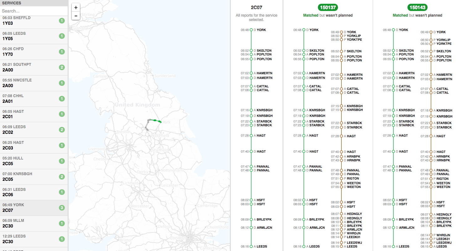
The UI is divided up into three vertical panes.
Left pane
On the left are all the services that the algorithm has seen so far. There are some numbers in coloured circles:
- green is the number of new matchings found that didn’t exist in the allocations
- gray is the number of matchings found that did already exist in the allocations
- red is the number of matchings that did exist in the allocations, but are wrong according to the algorithm
The services that are “interesting” (red and green) are shown first in the list, and the “boring” (gray) are last.
The search field at the top allows searching for:
- a headcode (e.g.
2C07) - a gps_car_id (e.g.
150148), which will find all services for the gps_car_id addedwill find services with green circlesunchangedwill find services with gray circlesremovedwill find services with red circles
Selecting a service will show more information in the middle and right pane.
Middle pane
The middle pane shows a map with:
- TRUST reports of the service in green
- GPS reports of the unit in brown
Only the selected service is plotted by default, but you can plot matchings by moving your mouse over them in the right pane.
You can also zoom by scrolling (or the + and - buttons) and pan by dragging. The current time of the simulation is shown in the top right corner (if the simulation is running).
Right pane
The right pane shows matchings of the selected service with different units.
At the top is the headcode or gps_car_id. If they are shown in green then the algorithm decided that they match, otherwise, if they’re in red, then they do not match, but are planned in the allocations.
Below them are the reports. In green are TRUST reports of the service, and in brown are GPS reports of the unit. The reports are sorted chronologically, with earliest at the top and latest and the bottom.
Moving your mouse over the reports will display on the map the approximate, interpolated location of the service and the unit at that specific time. This helps determine how close they were running, and whether they do indeed match.